
Diemer Cohen Stuart
Founder and CEO
- Physics engineer
- TU Delft (NL)
- 10yrs+ utility sector
- 8yrs+ experience GIS

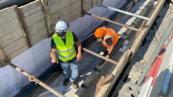
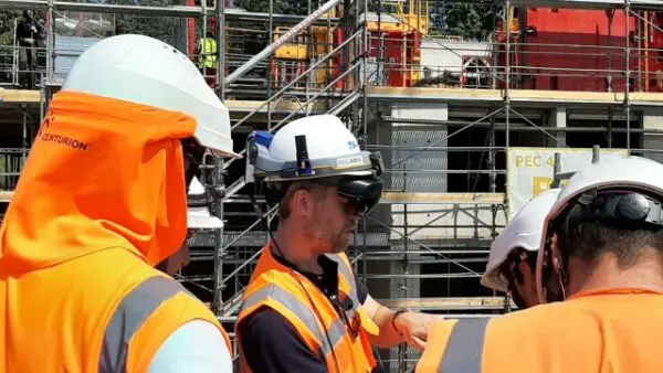
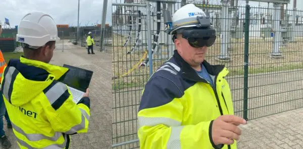
We visualize, modify and measure geospatial data with centimeter accuracy in the
field by using GNSS/RTK-integrated augmented reality glasses. Combined with
work instructions and remote assistance, we provide a powerful tool for utilities,
contractors and railways to further digitize and optimize their field operations.
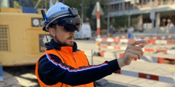
Use hands-free, high precision augmented reality to bring geospatial data to the field in an intelligent, accurate and innovative way helping our customers to revolutionize and optimize their operations in the field.
By providing high precision augmented reality, we simplify work for surveyors, contractors and engineers, allowing operators to execute their work more efficiently while improving data quality and reducing safety and financial risks.

We help surveyors, contractors and engineers to visualize, modify and acquire geospatial data with centimeter accuracy in the field by using GNSS/RTK-integrated augmented reality glasses.

“Thanks to V-Labs’ GNSS/RTK-integrated Augmented Reality solution, Deutsche Bahn can optimize the quality control of the installation of assets along the railway tracks. V-Labs’ technology allows Deutsche Bahn to optimize productivity, reduce delays caused by field work and improve data quality.”
“Ich habe in den vergangenen Jahren bereits etliche Systeme getestet, überzeugt hat mich allerdings nur jenes von V-Labs: «Die Projektion durch die Brille ist perfekt, überhaupt nicht verwackelt. Ebenso sind wir in der Lage, über die Cloud stets auf die aktuellsten Leitungsdaten zuzugreifen. Ein absoluter Game-Changer.»”
“De samenwerking tussen een drinkwaterbedrijf en V-Labs opent deuren naar een grensverleggende toekomst vol technologische vooruitgang.”
“Met het gebruik van Augmented Reality zien we nu ondergrondse obstakels voordat we een schop in de grond hebben gezet. Een mooie extra tool om graafschades te voorkomen.”
At V-Labs, we help utilities digitize and optimize their field operations through our high precision Augmented Reality solution for work instructions and geospatial data, allowing our customers, such as TenneT to achieve their operational and climate goals.
As major contractor, Implenia has innovation as integral part of its strategy, allowing Implenia to actively drive change within the industry and efficiently adapt its business to future needs. As such, Implenia uses Augmented Reality to optimize grid tracing.
V-Labs was one of the 29 startups selected out of 519 startups from 75 countries that participated in the Free Electrons bootcamp in Ireland: A major opportunity to present our technology and solution to leading utilities in the world.